UN
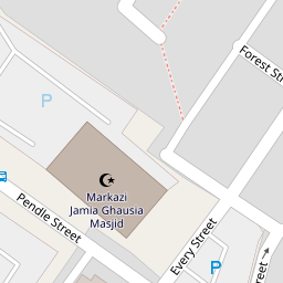
22 Every Street
£ 40,000
Description
We don't have a Description for this property.
- Bedrooms
- 2
- Bathrooms
- 0
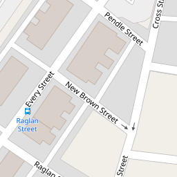

Leaflet © OpenStreetMap contributors
The heatmap indicates the level of crime in the area. The color of the heatmap indicates the crime severity and recency.
Metrics Year-on-Year
- Average area value
- 343,220.00 £Increased by 22.56 %
- Average area rental value
- 887.00 £/moDecreased by 15.12 %
- Est rental Yield
- 3.10 %Decreased by 30.80 %
- Crime Rate
- 6.00 %Unchanged by 0.00 %
from 280,040.00 £
from 1,045.00 £/mo
from 4.48 %
from 6.00 %
Nearby Schools
| Name | Type | Ofsted | Distance |
|---|---|---|---|
| Ghausia School | Other Independent School | Requires improvement | 0.41 KM |
| Bradley Nursery School | Local Authority Nursery School | Outstanding | 0.45 KM |
| Al-Ikhlaas Primary School | Other Independent School | Outstanding | 0.55 KM |
| Nelson St Philip'S Church Of England Primary School | Voluntary Aided School | Requires improvement | 0.56 KM |
| Whitefield Infant School And Nursery | Community School | Outstanding | 0.59 KM |
Images
Nearby Streets
| Name | Average Price | Average Sqft | Distance |
|---|---|---|---|
| Russell Street | £ 0 | 0 | 0.00 KM |
| Princess Street | £ 0 | 0 | 0.00 KM |
| Hope Street | £ 0 | 0 | 0.00 KM |
| West Rosser Court | £ 135,000 | 0 | 0.00 KM |
| Howard Street | £ 70,000 | 0 | 0.00 KM |
Nearby Transport
| Name | NLC | TLC | Distance |
|---|---|---|---|
| Nelson | 2565 | NEL | 0.52 KM |
| Brierfield | 2554 | BRF | 2.92 KM |
| Colne | 2562 | CNE | 4.05 KM |
| Burnley Central | 2550 | BNC | 6.09 KM |
| Burnley Manchester Road | 2549 | BYM | 7.12 KM |
Nearby Listings
| Address | Price | Type | Score | Distance |
|---|---|---|---|---|
| Every Street, Nelson, BB9 | £ 296,000 | BUY | 5 / 10 | 0.10 KM |
| Scotland Road, Nelson, BB9 | £ 145,000 | BUY | 4 / 10 | 0.17 KM |
| Sussex Street, Nelson | £ 55,000 | BUY | 6 / 10 | 0.26 KM |
| Surrey Road, Barrowford, Nelson | £ 169,950 | BUY | 6 / 10 | 0.65 KM |
| Chapel Street, Nelson, Lancashire, BB9 | £ 57,500 | BUY | 4 / 10 | 0.68 KM |
Nearby Properties
| Address | Price | Distance |
|---|---|---|
| 22 Every Street | £ 40,000 | 0.00 KM |
| 20 Every Street | £ 42,500 | 0.00 KM |
| 36 Every Street | £ 40,000 | 0.00 KM |
| 16 Forest Street | £ 65,000 | 0.05 KM |
| 24a Forest Street | £ 37,500 | 0.05 KM |